
Home / Our Company

Our Company

Technology is useful when it solves a real problem.

Maguire Aerial Mapping was built from practical experience.

Field photo A drone hovering above a new orchard development while Hamish, at the back of a ute, holds the controller.

After years working across horticulture and construction environments, we saw how often projects relied on incomplete plans, scattered photographs, manual measurements and information that was difficult to share.

Aerial mapping gave us another way to look at the problem.

Today, we're building Maguire Aerial Mapping around one simple idea:

Capture better information and make it useful to the people doing the work.

Our capability spans aerial mapping, RTK positioning, orchard design, photogrammetry, 3D modelling, progress capture and thermal imaging.

And as the technology develops, we'll continue expanding where it genuinely improves the information we can provide.

Field photo Hamish holding a drone controller and looking up, beside an RTK base station on a tripod, with a newly planted orchard behind.

What you can expect from us

  1. We start with the problem, not the drone.

    Flying is only one part of the job. Before we capture anything, we want to understand what you're trying to achieve, who will use the information and what needs to be delivered.

  2. We'll be clear about what the data can - and can't - tell you.

    Different projects require different levels of accuracy, capture methods and specialist expertise. We'll agree the scope and intended use before starting rather than making claims the data can't support.

  3. You'll know what you're getting.

    Before the job begins, we'll agree the area being captured, the deliverables, timing and any important limitations so everyone understands what the finished job should look like.

  4. Your information needs to be usable.

    A technically impressive model isn't much help if nobody knows what to do with it. We focus on presenting information clearly and providing deliverables suited to the people who actually need to use them.

  5. We're building for the long term.

    Mapping and inspection technology is moving quickly. We'll continue investing in equipment, software and capability where it creates genuine value for our customers - not simply because it's new.

The people you'll deal with

Portrait of Michelle Maguire

Michelle Maguire

Director

With a Bachelor of Laws (LLB), Michelle brings a strong legal, commercial and strategic foundation to Maguire Aerial Mapping. As Director, she oversees the company's corporate governance and executive operations. Her expertise and attention to detail ensure the business maintains strong financial oversight, effective systems and sound commercial practices, providing the structure and direction needed to support sustainable growth and long-term success.
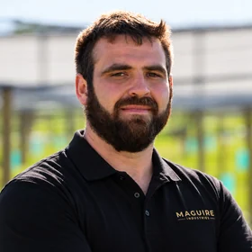
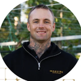
Portrait of Hamish Bryenton

Hamish Bryenton

Director & Data Engineer

With 10 years of horticulture experience and six years in engineering, Hamish combines practical knowledge of working environments with a technical approach to aerial mapping and data capture.

As Director and Data Engineer, Hamish leads the day-to-day direction of Maguire Aerial Mapping as well as its technical delivery. He oversees flight operations, mapping, RTK workflows and data capture, working from the customer's brief through to the finished project information.

Portrait of Jared Maguire

Jared Maguire

Chief Operations Officer

With 23 years of horticulture experience, Jared brings extensive hands-on site and project knowledge to Maguire Aerial Mapping.

He works directly with customers to understand what they're trying to achieve, scope the project and coordinate the work. His focus is making sure the technology serves a practical purpose and the information we deliver helps the customer make the next decision.

Our Equipment

Built around the job.

IllustrationDrag to turn

DJI Matrice 4E

Our primary mapping and modelling platform.

Designed for geospatial applications including mapping, construction and inspection workflows, the Matrice 4E combines RTK positioning with high-resolution aerial capture and mapping functionality.

Used for suitable:

  • Aerial mapping.
  • Orthomosaics.
  • Photogrammetry.
  • 3D modelling.
  • Construction documentation.
  • Progress capture.
  • Site mapping.

DJI Matrice 4T

Our thermal and inspection platform.

The Matrice 4T combines thermal imaging with wide, medium-telephoto and telephoto visual cameras and laser rangefinding.

Used for suitable:

  • Thermal inspection.
  • Solar inspection.
  • Building and roof inspection.
  • Infrastructure inspection.
  • Detailed visual inspection.
  • Asset documentation.

RTK equipment

Ground-based RTK equipment complements our aerial capability for suitable mapping, positioning and set-out workflows.

Equipment is selected around the accuracy, environment and intended use of each project.

Let's Talk

What do you need to understand about your site?

We'll help determine what information would actually be useful.